
Terrain Visualization for Go To Location (GTL)
A comprehensive guide to using the Terrain Visualization feature, which provides an estimate of the terrain features along your flight path, helping you safely navigate to your Go To Location (GTL).
Setting up your reference altitude during GTL (Go To Location) missions
Choose Your Altitude Reference between:
- Relative to Takeoff (RTL): Measures altitude relative to the drone’s launch point.
- Above Ground Level (AGL): Adjusts altitude dynamically based on terrain variations.
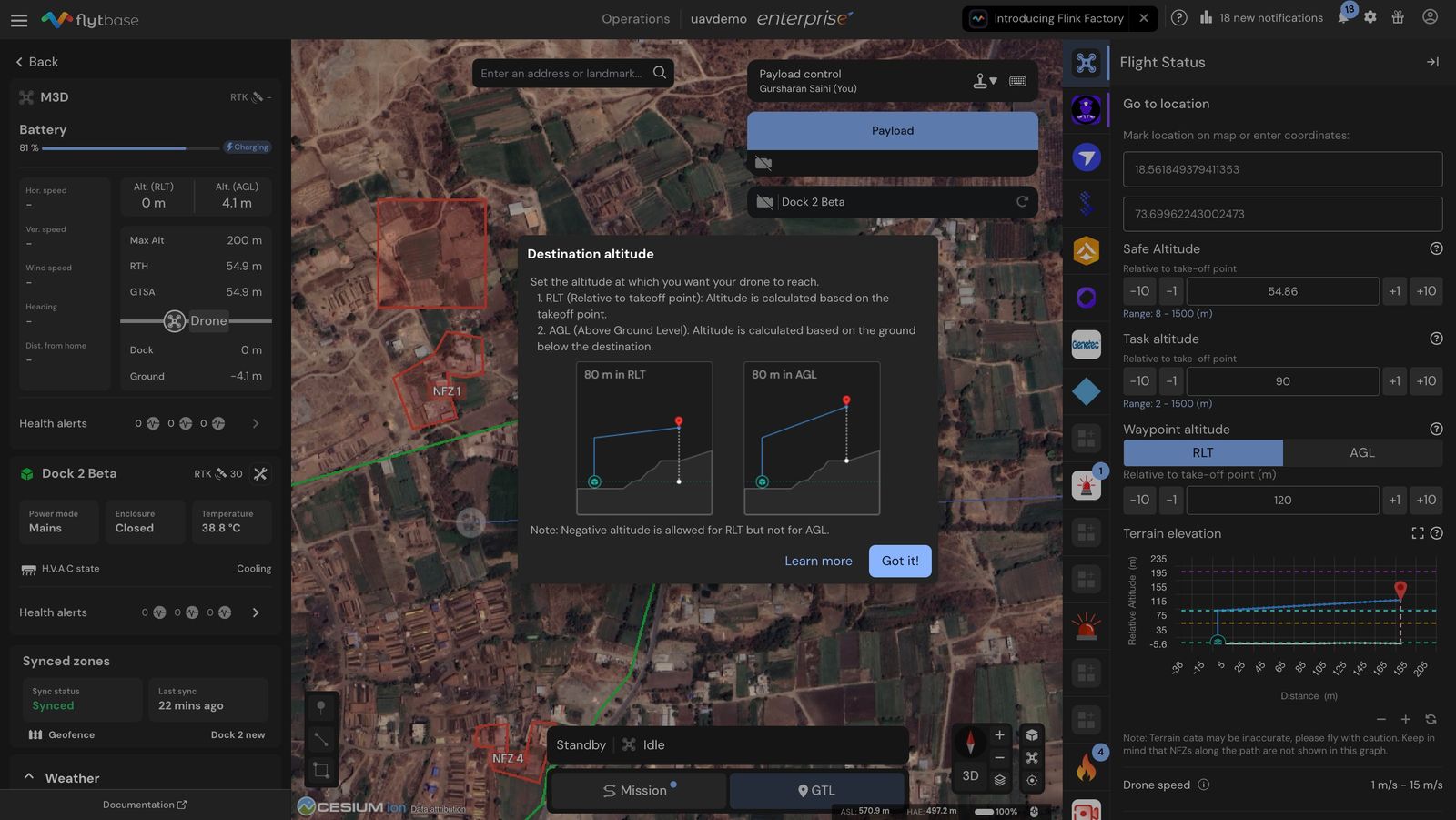
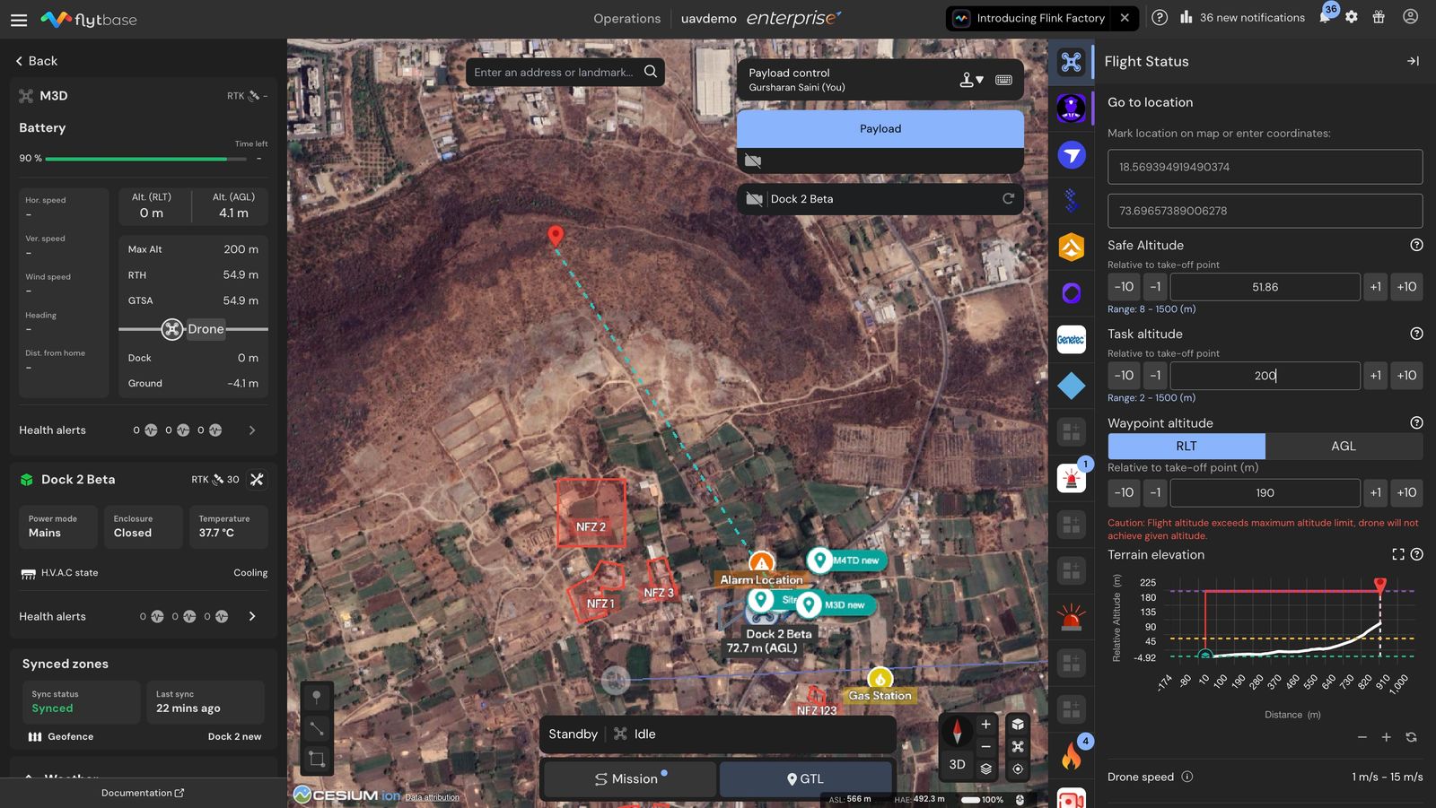
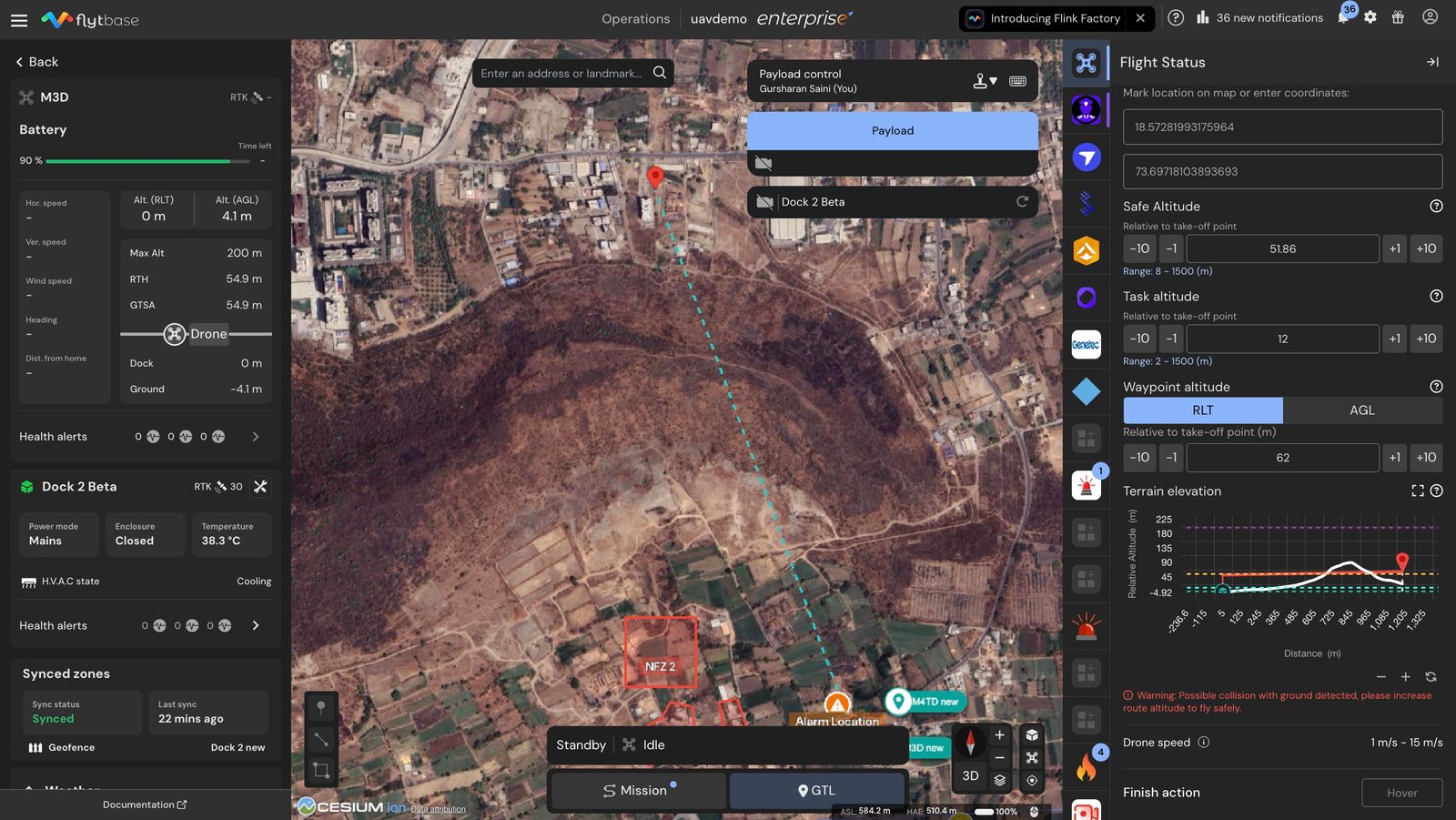
- Once you drop a GTL pin, the terrain elevation graph loads automatically in the right panel. You can use this to compare the planned flight altitude against the terrain below.
- To get a full-screen detailed view of the terrain profile, click the [ ] expand button in the top-right corner of the terrain graph.
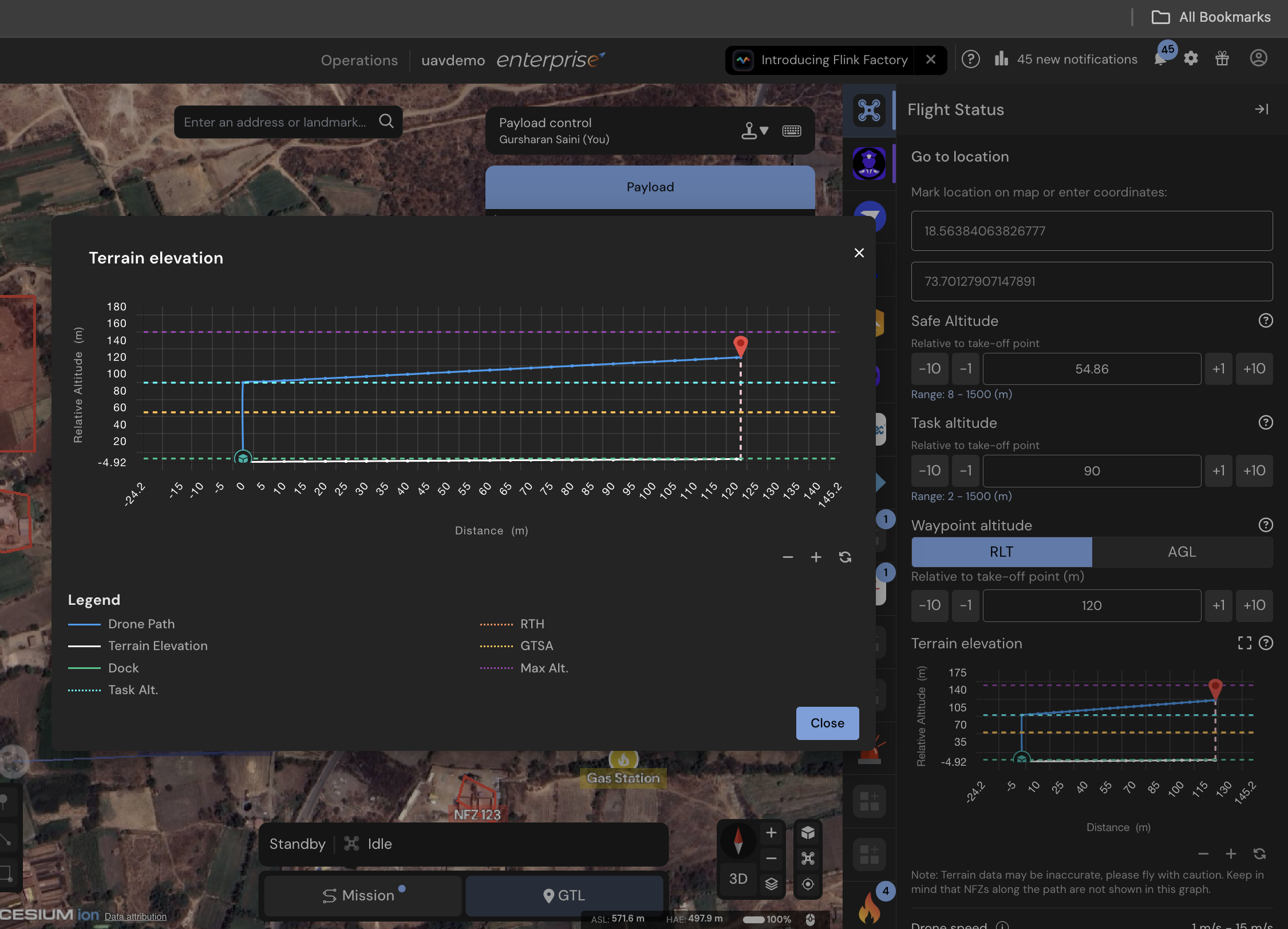
- Access the detailed terrain profile graph to analyze elevation changes and compare the Go To Location (GTL) target elevation for precise and safe navigation.
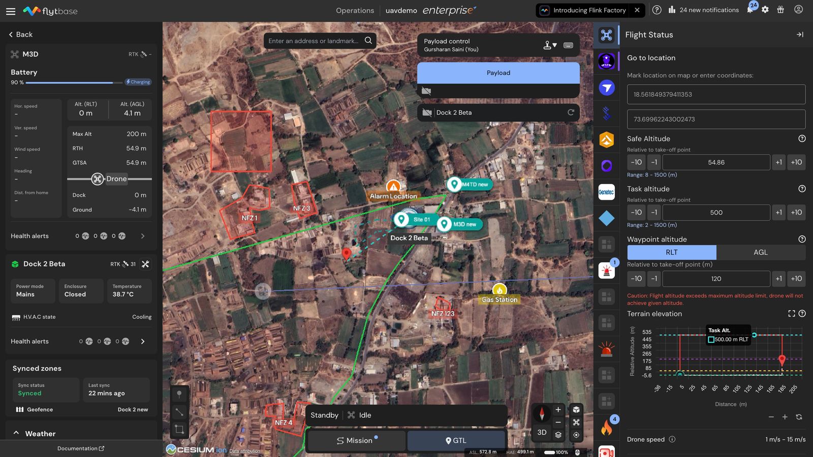
Pre Flight Caution Alerts and Warnings
Caution Alerts and Warnings: If the planned flight altitude exceeds limits or creates a conflict with the terrain, FlytBase provides an immediate warning, ensuring compliance with safety protocols.
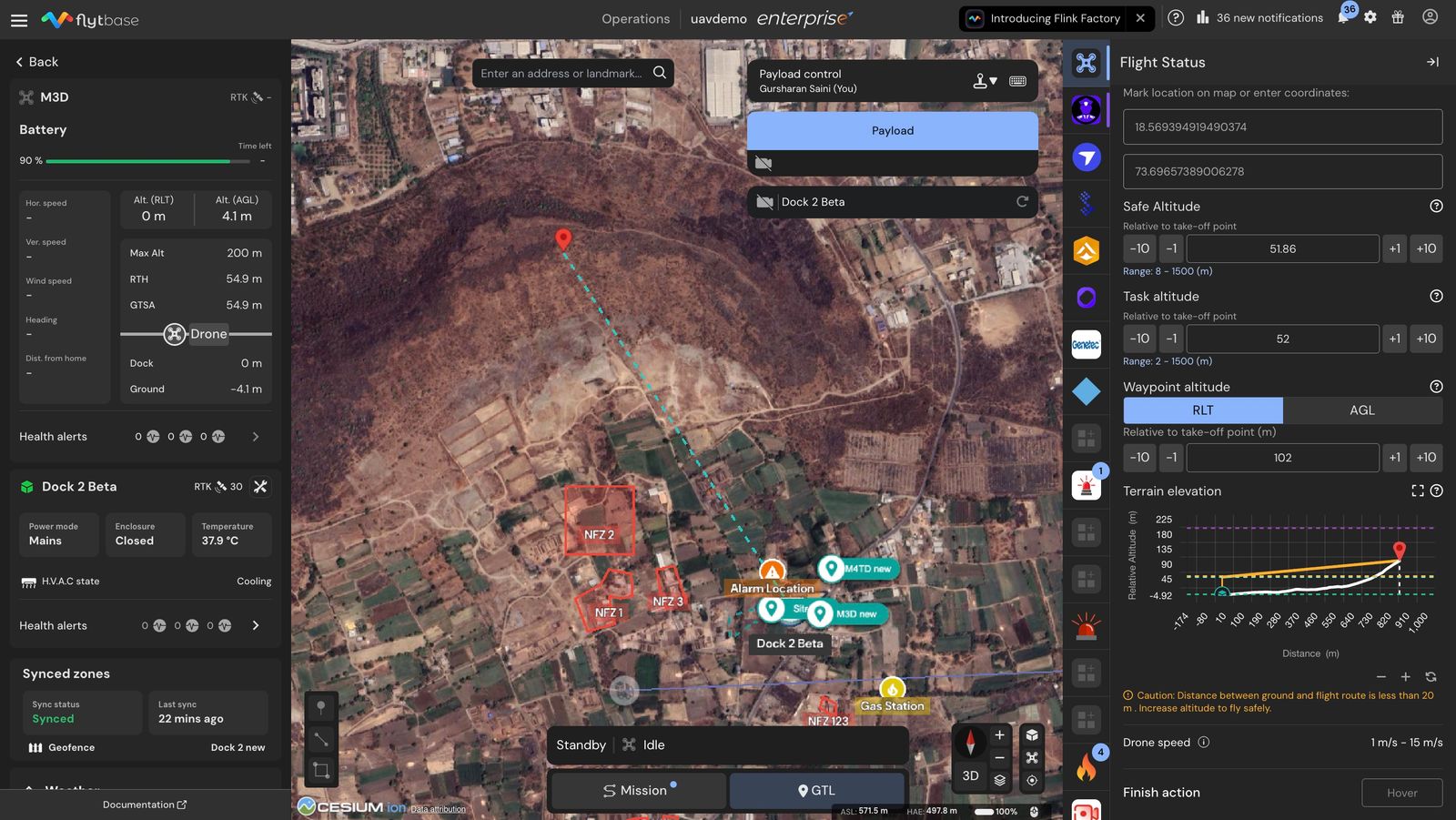
Operators would be able to see an advance warning under the Terrain Profile Graph in case the flight path would come in close contact with the ground (within 20 meters) at any point when the Go To Location (GTL) point is selected. In this case a review of the flight path is strongly recommended.
Operators would be able to see an advance warning over the Terrain Profile Graph in case any point on flight path exceeds the maximum altitude limit specified for the drone in device settings when Go To Location (GTL) point is selected. In this case a review of the flight path is strongly recommended.
Operators would see a warning under the Terrain Profile Graph in case any point on the flight path is within collision proximity with the ground when the Go To Location (GTL) point is selected to mitigate the collision risk. In this case, you would need to redefine the altitude parameter.
Was this helpful?